
Aerial Mapping & Field Reports
Using FieldWing Precision for aerial mapping and field reports have multiple advantages including:

Precision Field Mapping
We use high-resolution drone mapping to assess crop health, elevation changes, pest pressure, and more—helping guide treatment strategies.

Custom Treatment Plans
Maps are used to generate variable-rate spray plans or identify hotspot areas for targeted applications.

Reporting on Request
Reporting on Request: Visual field maps and digital reports are available to customers for review, planning, or recordkeeping.
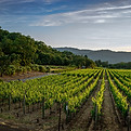
Orchard Intelligence
Orchard Intelligence: For orchards and vineyards, our system can count trees, detect gaps, and identify underperforming zones.

Data-Driven Decisions
Mapping allows you to make confident, cost-effective decisions that improve yield and input efficiency.